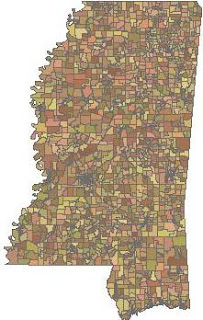
 Over Thanksgiving I finally got around to releasing the Python Shapefile Library. It is a single file of pure Python with no dependencies. It reads and writes shp, shx, and dbf for all 15 types of shapefiles in a pythonic way. You can find it with documentation here in the CheeseShop or search for "pyshp" on Google Code.
This library simply reads and writes shapefiles with no support for geometry calculations or the other eight or nine other supporting and undocumented shapefile formats including indexes and projection files which have been added since the specification was published in 1998.
Here's a basic example of writing a polygon shapefile:
import shapefile
w = shapefile.Writer(shapefile.POLYGON)
w.poly(parts=[[[1,5],[5,5],[5,1],[3,3],[1,1]]])
w.field('FIRST_FLD','C','40')
w.field('SECOND_FLD','C','40')
w.record('First','Polygon')
w.save('shapefiles/test/polygon')
There are plenty of other examples in the documentation.The library consists of a Reader class, a Writer class, and an Editor class which simplifies making changes to an existing shapefile by giving you one object to work with so you don't have to juggle the Reader and the Writer objects yourself.
Beyond the docstring tests and some unit tests I tried PSL out in Jython with no issues. It's been awhile since I've run the tests. I want to try out Jython again as well as the other Python implementations which have a "struct" and some form of "os" module. I don't expect any issues with IronPython.
My company sells industrial-strength, native shapefile libraries for Java and Visual Basic which I was not involved in developing. I wrote this simple library to fully learn the shapefile specification for my own curiosity and to lead to some improvements in our commercial libraries. I learned quite a bit and we plan to release some very interesting features to our JShapefile and VBShapefile libraries in 2011 which will solve some major annoyances faced by developers who work with the shapefile format on a regular basis. More on that later...
PSL is not the only way to write shapefiles with Python however as far as I know it is the only complete pure Python library. Every other option is a Python wrapper around a C or C++ library (not that there's anything wrong with that) or partially-developed in Python only. I like having a pure Python, dependency-free, no-setup choice even if it's much slower than a highly-optimized, C-based module. Here's why:
- C-based modules can't follow your code everywhere - at least not easily (ex. Google App Engine and other web hosts, many embedded platforms, Python on different runtimes such as Jython and IronPython)
- Unless the developer really goes out of his or her way, C-based geospatial libraries wrapped in Python have kludgy-feeling methods and return opaque objects. There are notable exceptions to this rule but they are few and far between.
- Speed is the #1 reason developers cite as a reason to create C-based Python modules. In the geospatial domain the complexity of the data formats and spatial calculations makes wrapping libraries the easier choice. But most developers use Python because of the speed of development and ease of maintenance rather than program execution. In the rapidly-growing geospatial technology world new ideas are coming out every day. Rapid application development is key. The more easy-to-use, easy-to-change libraries the better.
ShpUtils - Zack Johnson's pure-Python shapefile reader.
Shapelib - The original C-based shapefile library with Python bindings.
Pyshape - an alternative shapelib wrapper
OGR - General vector read/write library from shapelib creator Frank Warmerdam
Shapefile - a pure-Python read/write module under development
No comments:
Post a Comment