Back in mid 2003
NVision had just a handful of geospatial programmers and we were relatively unknown outside of the
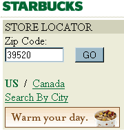
NASA Stennis Space Center incubator which housed our tiny office. So I was surprised when a stranger who had googled us called asking about a adding a zipcode store finder to his website. "Simple enough," I thought.
I quickly did the calculations in my head for labor and data preparation of an HTML iframe containing a form with an ArcIMS map. I put the stranger on hold and ran my estimate by my boss. It sounded reasonable to him. So I took the stranger off hold and said, "Yes sir, we can do that for about $2,000." He repeated the figure back to me in disgust, "Two-THOUsand dollars? Are you kidding me?" He hung up. I was caught off guard. Didn't this guy realize what he was asking for? Geocoding stores, running those points against polygons, returning a distance to the would-be customer - and all on the Internet of all places. This was before GoogleMaps mind you.
Of course the point of all this is to show how far we've come in 6 years. Now zipcode calculators are a nifty hack people blog about using their cell phone on the way to the airport. And there are plenty for Python.
Here's several Python zipcode calculators in order of complexity.
This one uses a database built in MySQL:;
http://jehiah.cz/archive/spatial-proximity-searching-using-latlongs
This one provides a python interface to geonames.org:
http://www.zindep.com/news/interface-python-pour-geonames/?searchterm=geonames
Here's one using SQLObject to store the data
http://www.zachary.com/s/blog/2005/01/12/python_zipcode_geo-programming
And just to show how common this concept has become - it's now a casual entry in the Python Cookbook alongside other
bits of trivial python code:
http://code.activestate.com/recipes/393241/
Granted some of these scripts are distance calculators but I have to concede the stranger who called me in 2003 was absolutely right but maybe a little ahead of his time. It was really more of a $200 problem than $2000.

